 Headed to Luddenham as a base start for the storms approaching and rapidly becoming severe. Traffic stopped me heading onto the M4 so I had not choice but to bear the brunt of the storms and hail 2 to 3cm in diameter (estimation). On Elizabeth Drive towards Kemps Creek, a massive lightning bolt hit what ma have been a tree as a fresh branch had impeded traffic. A barrage of massive lightning bolts occurred behind me and I was not game to stop and film in that environment.
 I headed for Horsley Park where once again reports of an accident on the M7 changed my plans to head north.
The edge of the core produced hail perhaps to 1cm in diameter.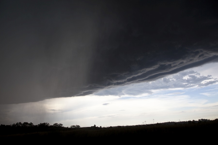
Jimmy, I saw that storm in the distance to the north. From the south near Picton, all I could see were the rain shafts and I did not see the base. I headed west of Picton instead to keep away from the traffic then went back to Mittagong for the second time. I was able to document a hail event near Appin. I will post photos as soon as possible as I have not even looked at them yet. Some of these storms had very nice structure and great updraft towers but it meant having to constantly move around to keep up with the storms and updraft towers.
Jimmy, I saw that storm in the distance to the north. From the south near Picton, all I could see were the rain shafts and I did not see the base. I headed west of Picton instead to keep away from the traffic then went back to Mittagong for the second time. I was able to document a hail event near Appin. I will post photos as soon as possible as I have not even looked at them yet. Some of these storms had very nice structure and great updraft towers but it meant having to constantly move around to keep up with the storms and updraft towers.
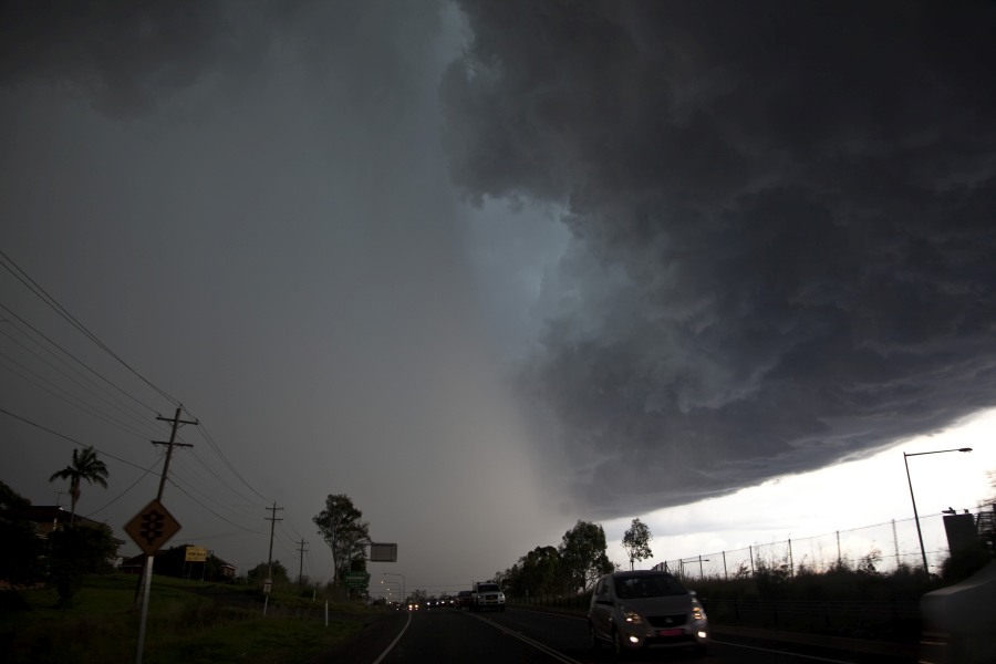
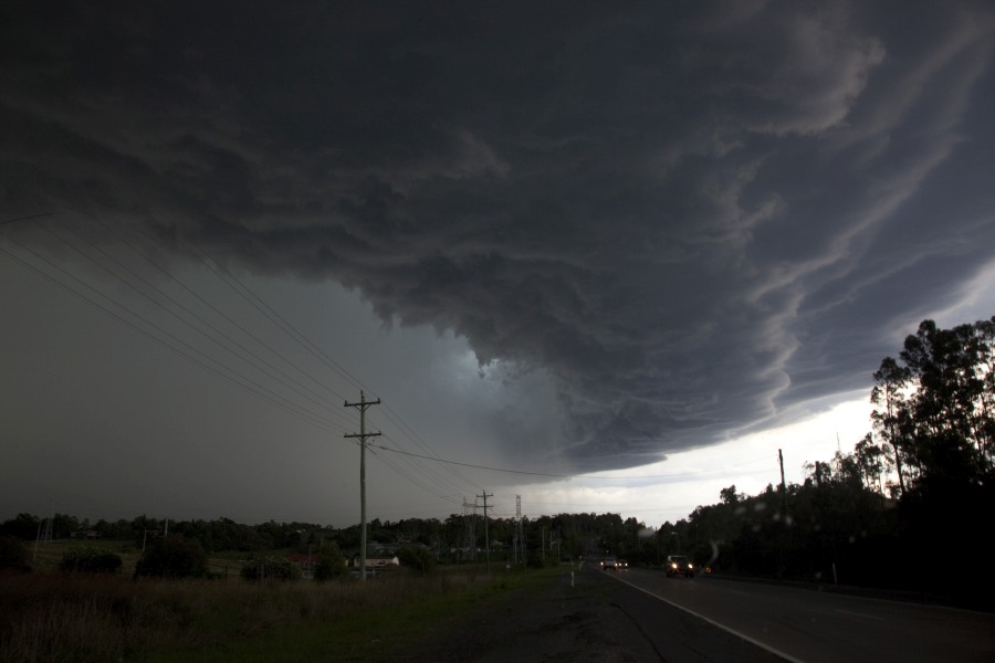
After school pick up was never better than yesterday’s dynamic striated shelf cloud with some great cg’s passed over Parramatta. There was brief hail to pea size.
I commenced a storm chase across south west Sydney early afternoon by heading south west to Luddenham and then the Greendale area. Early afternoon, I watched a storm cell develop on the lower Blue Mountains which struggled at first but slowly it gained momentum as it tracked south east.
At the same time, I took interest in two northern storms with one west of Berowra and another small cell around Windsor. I had a choice to make whether to return to Sydney or head towards Picton.
After taking some photos as a sequence and reviewing the photos taken and when comparing the southern storm, I made a choice by going south to Picton. I eventually went south to Mittagong and it was clear that I had made a very good decision. The southern storm intensified and I was excited to see what was occurring.
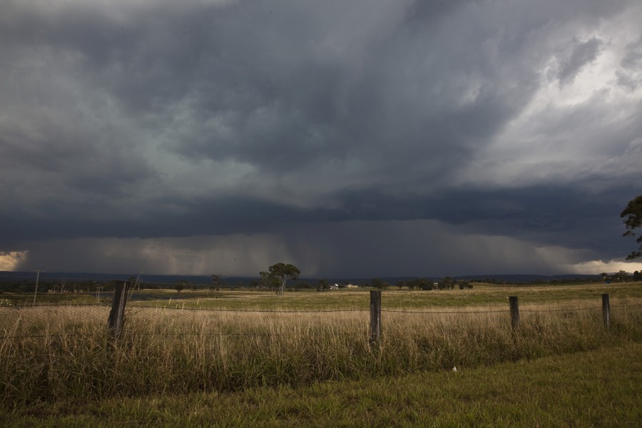
Near Mittagong I had to break through a moderate rain shower and I was stunned to see a very intense thunderstorm ahead of me complete with a rain free base ahead of me. This was a serious storm cell by the time I arrived at Braemar. I found a place to stop and a large paddock and started taking photos but was forced to flee when two substantial lightning strikes occurred a little too close to me. This storm featured a green hue at its base and it was clear that there was hail falling but to the south east within a rural area.
The first photo shows the storm just south of Campbelltown early afternoon looking south / south west.
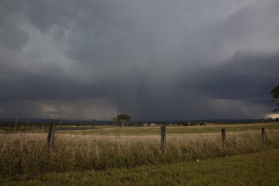
Here are the photos for the Mittagong storm.
After took a sequence of this cloud, I relocated back to Hilltop due to the close proximity of lightning strikes. This storm moved NE but I could tell that it was dumping rain and hail. This was an intense storm.
I watched the storm from a vantage point at Hilltop and took a number of photos. As soon as the outflow winds reached me, I left the area and returned towards Campbelltown.
One hour later, this storm ceased to exist and only a mass of cirrus cloud was evident.
Some further photos of the Mittagong storm from Hilltop.
I reached Picton Road from the Hume Freeway and took interest in this small LP type storm cell over Campbelltown and a much larger cell moving onto Sydney from the west. Although where I was, I could not see too much cloud structure within that cell. I watched this storm for approximately 30 minutes and decided not to chase it.
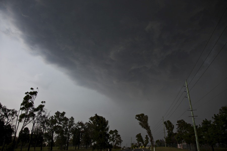
Instead, a southern storm cell caught my interest so I decided to head west to Picton where I took photos of this interesting base (It takes the form of a small arcus cloud). I found this storm interesting so I followed it for a while. The second photo shows the base of the storm cell.
I drove west of Picton and watched this storm decay from a vantage point but not before obtaining this wonderful lightning strike. I did not see any more lightning strikes from this cell after this one.
I did photograph this unusual cloud during the chase. This is not a funnel cloud but it survived for a number of minutes.
A much stronger storm cell was evident south around Appin so I drove south and intercepted it on the Hume Freeway where I barely missed a hail event. As it was, I drove into the western edge of the rain and I noted large areas of the ground covered in white hail. I arrived on the scene just as the storm concluded so the hail was fresh.
I was able to stop the car at a good location and view the hail which had not melted.
Hail sizes varied from pea size to almost 3 cm. While I did not have any calipers with me, the stones in my hand shows the size of the larger stones that fell.
I noted hail fog developing in the area and there was some hail fog evident upon my return drive. There were hail drifts under trees as shown.
Following this, I drove back to Mittagong only to intercept a second storm there before returning to Pheasants Nest to observe another storm.
The last photo below shows the storm cell that produced the hail.
After spending some time at Pheasants Nest and further time on Picton Road watching and photographing storms, I returned back to Sydney.
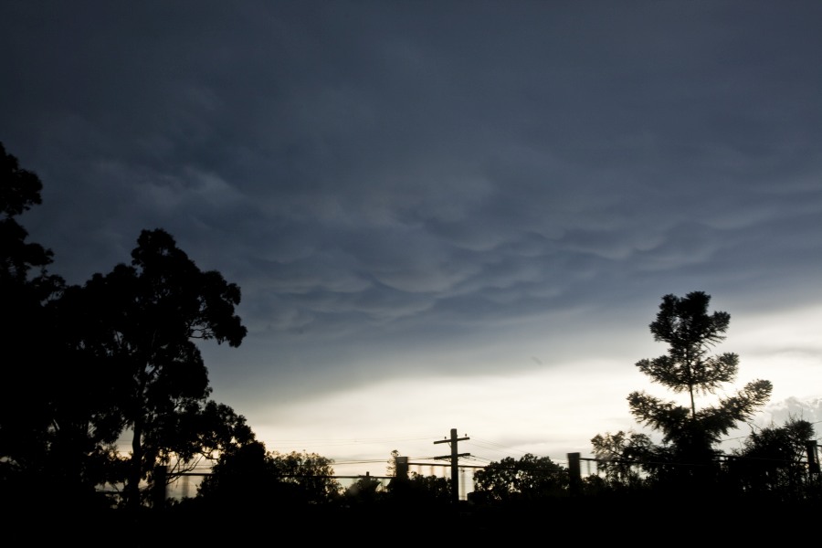
I was treated to a wonderful sunset over western Sydney with the sun illuminating the western side of a large anvil cloud creating a bright orange glow.
I consider my south west Sydney and northern Southern Highlands storm Chase a very good chase at days end. It meant having to move quickly from cell to cell to get the photos and cloud structure. My chase area chosen was fortunately free of traffic so I was able to move freely between storms without being hindered and that enabled me to get a good selection of photos from each cell.
Didn’t get a chance to try any photos on Friday, as I had been out near Fairfield all day on a job related to lightning taking out a service the night before. Got home to Waitara at about 4 to get ready to head into the work Christmas Party. About 4:50 started hearing thunder and decided I had better get the train sooner rather than later or I would get drenched. Some awesome lightning bolts while I was walking up to the station, almost makes me wish I had aborted the party and just tried photos. The lightning followed us down the North Shore line for a number of stations with close lightning and there was hail on the platform at Gordon, probably about 1cm size.