Hailstorm hits Sydney with hail drifts

On Anzac Day afternoon 25 April 2015, I chased storms with Jimmy around Western Sydney. The event is well covered by Jimmy in his post so I will not repeat what has been stated. Generally we were working together to produce the best result for the day and we achieved far more than expected. Personally, I had not expected to see such a thunderstorm that produced prolific hail.
I had not undertaken any prior forecasting as I was busy working on other projects. However, when I received the phone call from Jimmy regarding the storms, I jumped at the offer and happy to be the driver.
I initially saw the cumulus towers to the west which looked interesting. After collecting Jimmy from his home, we went to local lookouts and watched the early cloud towers that initially struggled. Then it was off to nearby Rooty Hill and then Penrith Lakes where the action started.
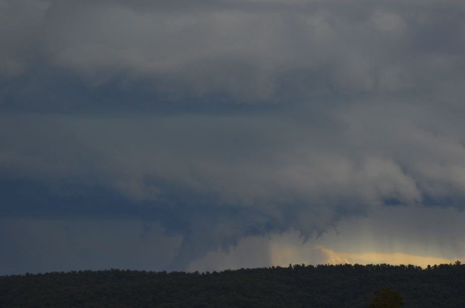
The first storm with a very interesting base was visible to the west. I post one photo that shows a very interesting base but identify that it is no funnel cloud. It is just lowered cloud with hills in the way but it shows the structure of the cloud base.
When this was close enough, it was a case of driving south through Penrith then east along the M4 Motorway. We were initially going to intercept this storm but a new growing and broadening cloud base was of more interest so we decided not to go south but wait. That proved to be a very good move.
The storm passed over us where we were being within the Wonderland Industrial Park. There were three bursts of hail from it and heavy rain. We then shifted north then east onto the Great Western Highway where the best hailstorm I have seen for a long time occurred. There were hail drifts and I could not see the road surface. There were plenty of photo opportunities and at one stage became stuck in hail but managed to get clear and continue.
Some of my favourite photos include having the car bonnet carpeted with hail and holding a large conglomerate of hail in my hand where hail had fused together.
We finished up getting another hailstorm over Blacktown and a further event around Prospect before returning to Pemulway and later the M4 Motorway Caltex Twin Service Stations to measure hail size.
The chase ended towards evening and it certainly made a fitting end to the storm season.
Some of the early cloud towers were struggling but as the afternoon progressed, the clouds became more consolidated as cumulonimbus clouds (Image 1) and upon our arrival at Penrith, the storm structure was visible (Image 2).
There was a hailstorm at Blackheath where hail upwards of 2 cm fell.
The images shown are generally looking west.
Another picture of the storm base prior to driving south through Penrith. (Image 3).
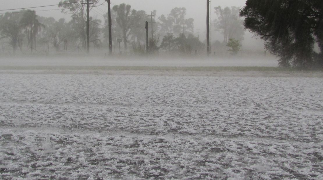
Image 4 shows the early hail within the Wonderland Industrial Park where the former Wonderland Park used to be. The hail was small but fell in three bursts then we left.
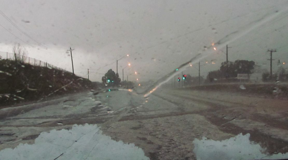
Hail fall on the Great Western Highway – Between Wallgrove Road (West) and Flushcombe Road (east) and travelling east with hail drifts. This made driving slow and tedious. Interesting to see so few motorists able to handle this event with many pulled over. Images 5 and 6 were taken out my window looking south.
Note:- It was in this area where 5 factory / warehouse roofs collapsed due to the weight of the hail fall (Huntingwood Estate). Fire fighters also attended a small fire at one unit so one emergency created another emergency in this area.
Eventually the west bound lanes were closed by emergency services due to what was occurring.
An image of hail fused together on the bonnet of the car (Image 7). It gives an idea of the depth reach in the affected area.
An image of the second storm to the east of Seven Hills over Parramatta and North Parramatta (Image 8).
Note:- It is identified that SES and emergency personnel attended to over 1,000 calls for help from this event.
Once the event was over, we drove to Pemulway then the Twin Caltex Service Stations to measure hail fall and size.
Images 9 and 10 shows some hail.
We measured stones from pea size to 2 and 2.5 cm. It is generally safe when factoring in the melting that some hail stones may have reached at least 3 cm in size.
The final image shows some hail drift.
RAINFALL
When looking at the rainfall plot it shows falls of 51 and 58 mm around Prospect Dam and Pemulway being the heaviest falls. This is the vicinity of where this event is described. This rain fell in the space of one hour or less. The rainfall was indeed heavy which created much overland flow and flooded roads, made worse by the hail fall.
To conclude the post, I attach the final rainfall plot for the 24 hours to 9 am Sunday morning. There were further showers and storms later in the evening. Top rainfall including the later showers was 60 mm at Prospect Dam, 53 mm at Blacktown Dog Pound and 51 mm at Greystanes.
http://www.extremestorms.com.au/spectacular-25-april-2015-hail-storm-and-hail-drifts/#comment-2903
http://www.extremestorms.com.au/spectacular-25-april-2015-hail-storm-and-hail-drifts/#comment-2903
Nice hail drifts and hail cluster!
Nice hail drifts and hail cluster!
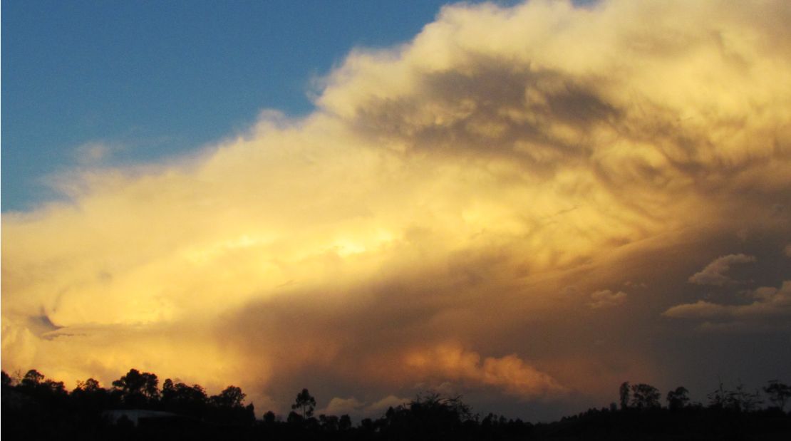
Harley Pearman, the sunset selection is very impressive!
Harley Pearman, the sunset selection is very impressive!