For two days, rain and storm events have been a features across northern Victoria and large areas of New South Wales. Some of the individual storm events have been significant in terms of their impact and numerous severe weather alerts were issued.
The event overall produced beneficial rainfall although heavier falls are localised.
During Saturday, storm events were concentrated within northern Victoria and inland south west New South Wales. A squall line crossed inland southern New South Wales then weakened as it approached the coast. There were some late afternoon storm events mainly across the more sparsely settled regions of the Riverina which continued into the evening.
Rainfall to 9 am 1/1/2015 include:-
Upper Goobarragandra - 70 mm.
Long Plain - 63 mm.
Batlow - 62 mm.
Argalong - 57 mm.
Mt Ginnini - 52 mm.
Cassilis - 48 mm.
Trangie - 40 mm.
Merriwa - 39 mm.
Mundario - 38 mm.
Wagga Wagga - 27 mm to 29 mm.
Some of the centres or localities are close to the Snowy Mountains where the heaviest falls occurred.
There are media reports of a thunderstorm producing hail to 4 cm in size in the Victorian regional city of Bendigo and another hail event at Dunolly.
During Sunday, storm activity became far more widespread and storm events reached Sydney and the Central Coast. Heaviest rainfall from the storms to 9 am 2/11/1015 include:-
Long Plain - 77 mm.
Batlow - 63 mm.
Corin Dam (ACT) - 57 mm
Tooma Dam - 55 mm.
Cabramurra - 49 mm.
Some of the more significant weather events include:-
Hay - During a storm event, a wind gust of 117 km/h was recorded at the weather station at 2.29 to 2.33 pm.
Shepparton - A peak wind gust of 89 km/h was recorded at 3 pm and again at 3.03 pm from a passing storm at the local weather station.
Yarrawonga - In addition to 23 mm of rain falling, a wind gust of 72 km/h was recorded at 3.25 pm and again at 3.30 pm.
Temora (Riverina) - Which has been experiencing extended dry periods received 20.4 mm and 33.4 mm respectively.
Wagga Wagga - At least 56 mm of rain fell across the two days easing the big dry developing across that region.
Strathmerton (Victoria) - A significant storm impacted the Victorian town causing damage although it is not clear whether it was a tornado or simply damaging winds from a passing thunderstorm as information is sketchy. There are images of damaged homes following the event.
Wisemans Ferry (North of Sydney) - A passing storm at 2 am 2/11/2015 saw the rainfall increase dramatically from 1.8 mm to 12.4 mm within 30 minutes.
Penrith - Late storms on Sunday including another storm event early Monday morning resulted in 24.6 mm of rain falling.
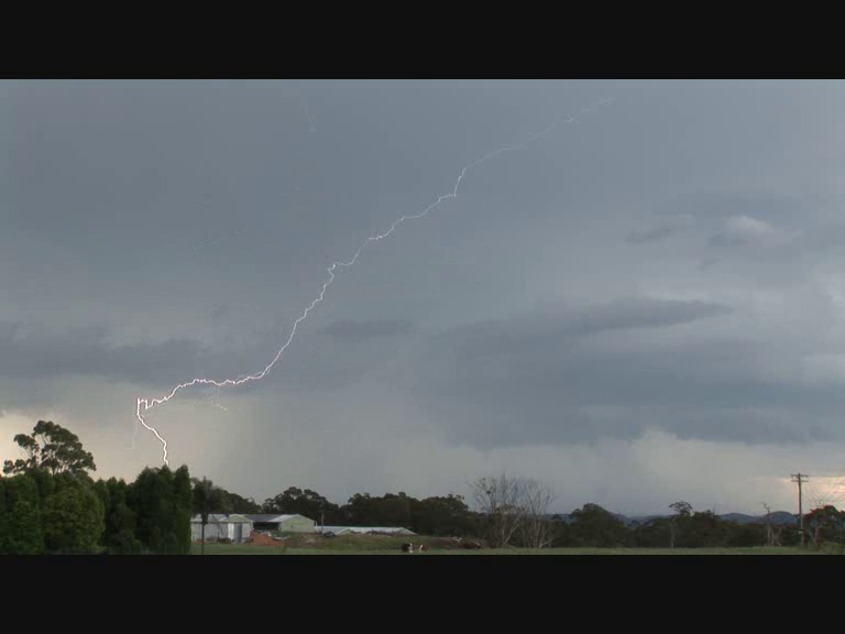
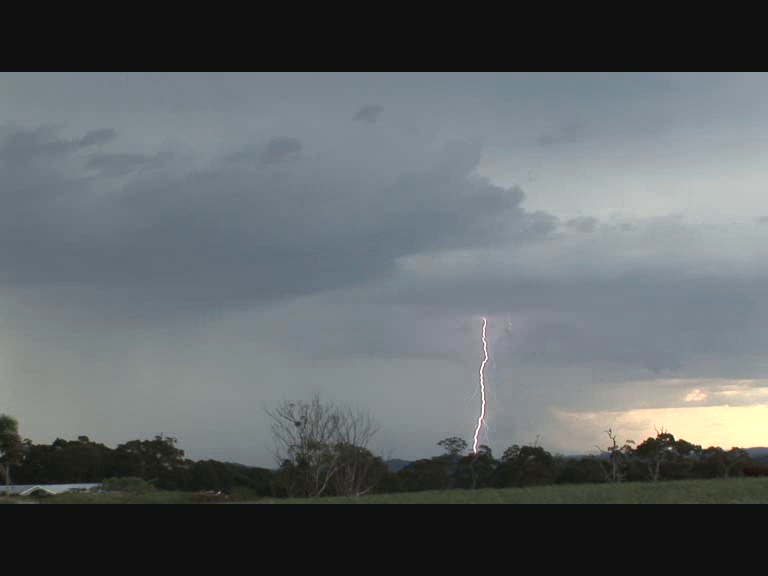
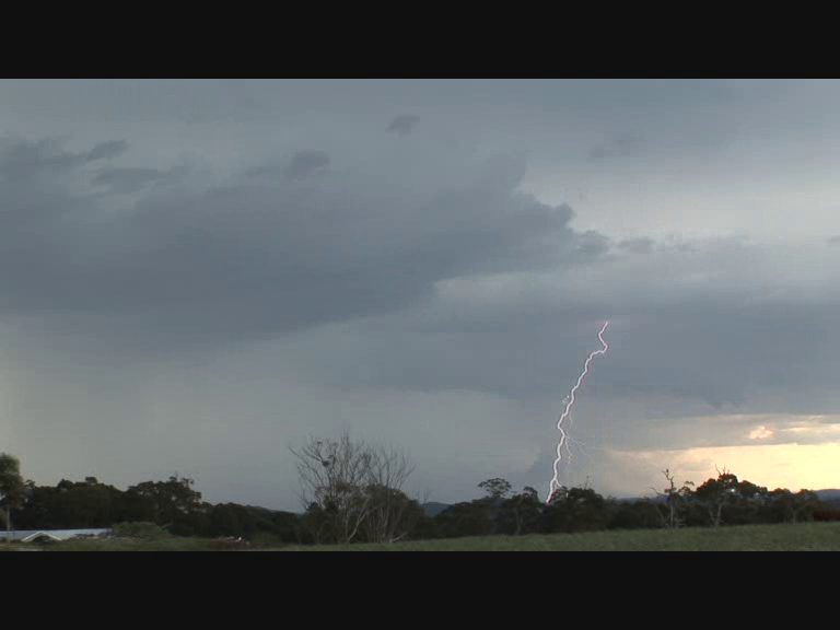
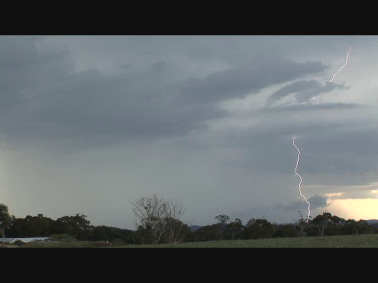
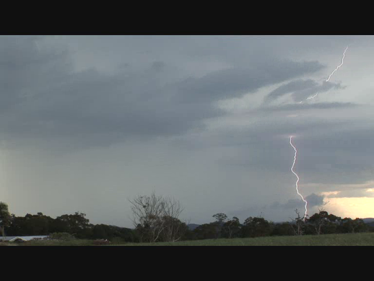
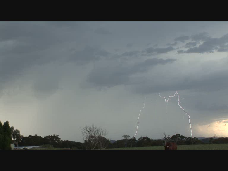
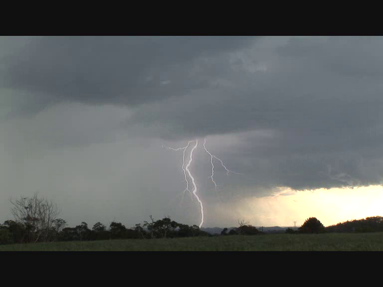
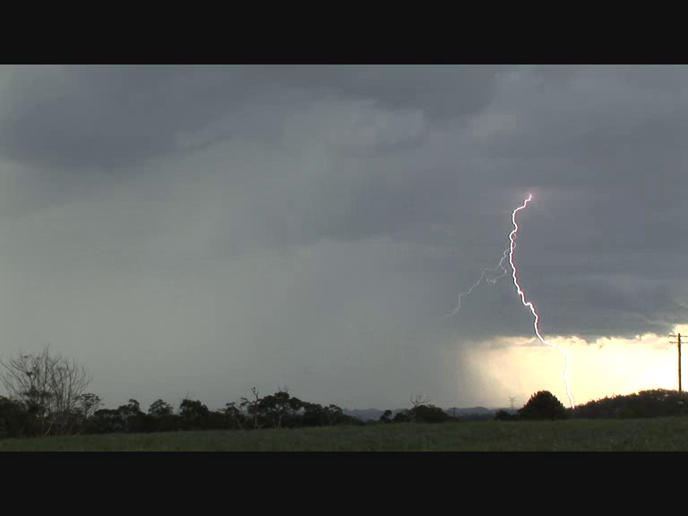
The photos attached are from one such storm that occurred near Mangrove Mountain north of Wisemans Ferry (New South Wales). This was a very lightning active storm in which many cloud to ground lightning strikes were observed , filmed and photographed. This was a storm that Jimmy, Colin and myself intercepted during a storm chase between Sydney and Newcastle during Sunday afternoon. The images demonstrate one of many storms that impacted the state during the event.
Multiple Vortex Tornado - Nathalia, VICTORIA. 01/11/2015
https://www.youtube.com/watch?v=Cpppj8hgov4