Over recent days, two new typhoons have developed across the Western Pacific Ocean both of which have the potential to become powerful storms. One such storm is called Typhoon Atsani and the other storm is called Typhoon Goni.
Both storms have formed in a very favourable environment with ideal sea surface temperatures and both are currently over open ocean. One storm namely Typhoon Goni is already posing a threat to South East Asia either the northernmost part of Luzon Island (Philippines), Taiwan (Which is still recovering from the previous typhoon Soudelor) or south east China or Hong Kong.
The other storm Atsani is currently over open ocean but tracking north west towards southern Japan.
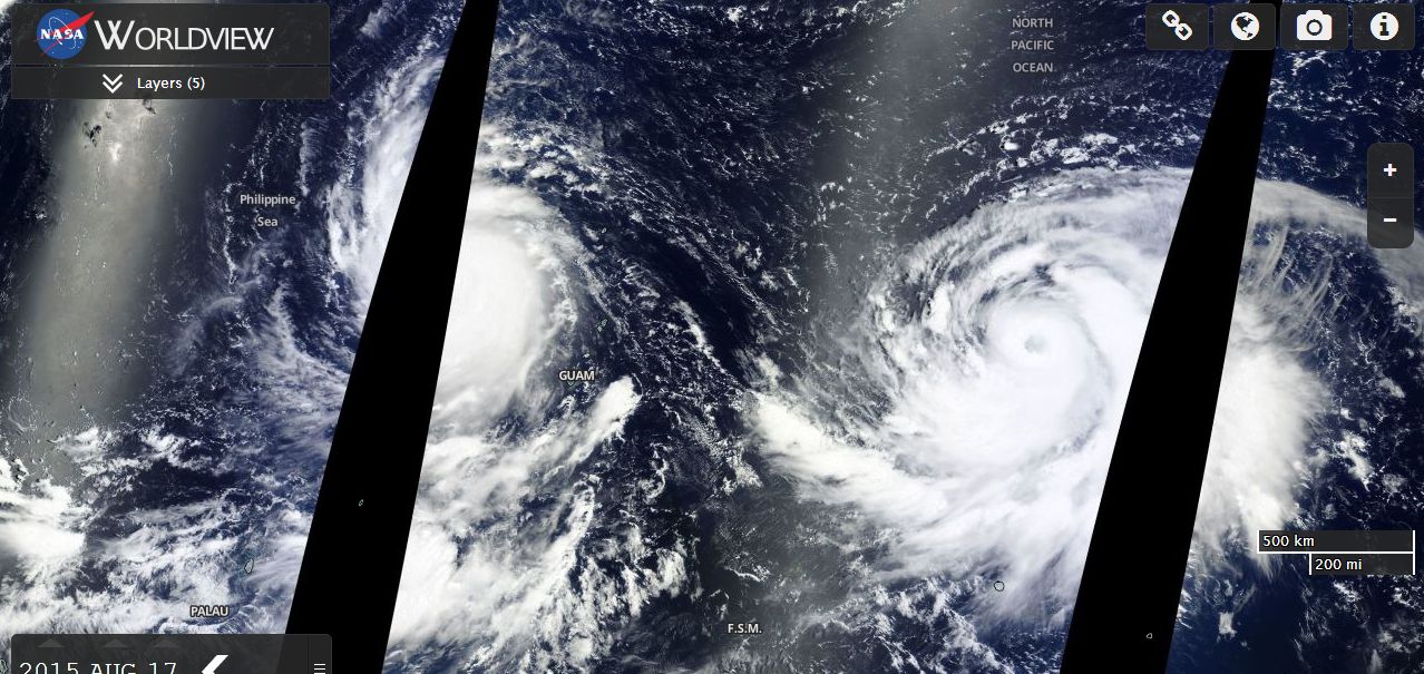
Both storms are relatively close together as shown on the attached MODIS Worldview satellite photo acquired 17/8/15 from NASA.
Typhoon Atsani
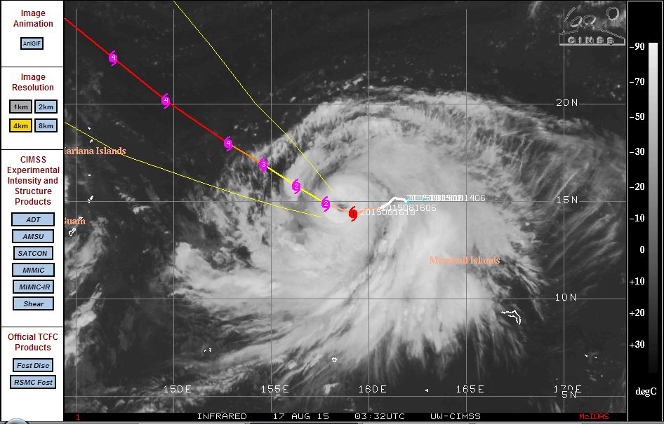
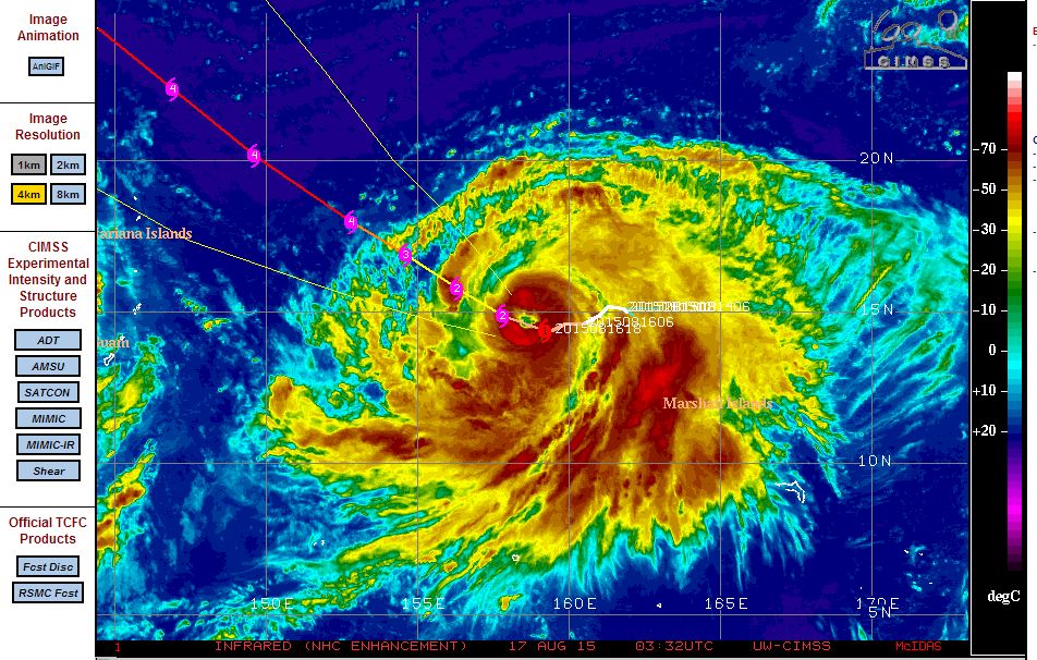
Typhoon Atsani is currently located at 14.4 degrees north and 159.2 degrees east and tracking North west at 4 knots (Approximately 7.5 km/h). At the present time, this is a slow moving storm. Other features of the storm are:-
1 - Has a well defined eye wall with notable convection occurring around the eye and features spiral rain and storm bands.
2 - Current wind speeds of 75 knots (Approximately 139 km/h) with wind gusts to 90 knots (Approximately 167 km/h).
3 - Could potentially become a powerful category 4 typhoon in 2 days with wind speeds of 125 knots (Approximately 231 km/h).
According to the CIMSS model (Attached and acquired 17/8/15), the storm should move north west towards southern Japan but remain over open ocean for the immediate future.
Typhoon Goni
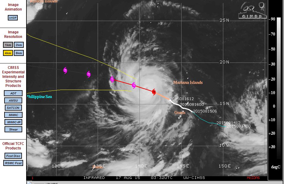
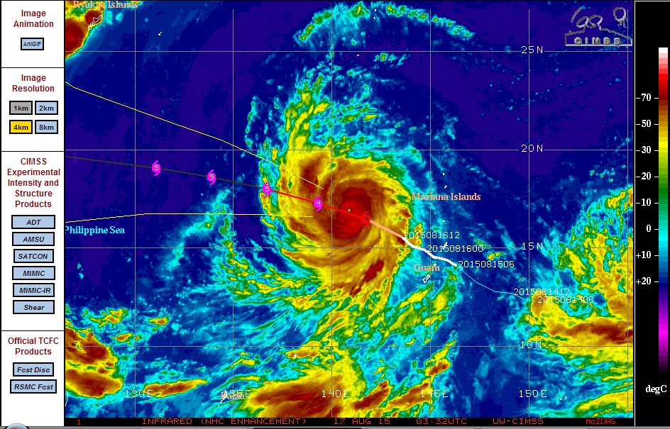
Typhoon Goni appears to be the stronger of the two typhoons and it is possible that this storm could become a Category 5 storm or even another super typhoon.
The storm is currently located north west of Guam but formed west and north west of Guam and the Mariana Islands. The storm passed over the islands as a tropical storm before rapidly intensifying into a typhoon. The storm is currently located at 16.5 degrees north and 141.7 degrees east and expected to track west north west over coming days as a Category 4 and even a Category 5 typhoon. The storm is moving west north west at 11 knots (Approximately 20 km/h). Other features of the storm are:-
1 - Has a well defined eye wall with notable convection occurring around the eye but it is a smaller storm than Atsani.
2 - Current wind speeds of 115 knots (Approximately 213 km/h) with wind gusts to 140 knots (Approximately 259 km/h).
3 - Could potentially become a powerful category 5 typhoon in 24 hours with wind speeds of 150 knots (Approximately 278 km/h).
According to the CIMSS model (Attached and acquired 17/8/15), the storm should move west north west and is a threat to south east Asia due to its location and its projected movement. This is the storm to watch over coming days.