For the second time in the space of twelve months, a moderate to major flood event has impacted the Hawkesbury River basin across outer Western Sydney. However, the only positive aspect of this is that the flood peak was less than that of March 2021. The images shown in this post are almost identical to the images obtained during previous flood however this time, I managed to be within the area just after the passing of the flood peak.
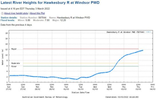
According to the Bureau of Meteorology – “River Flood Levels” and it’s recording station at Windsor PWD, the flood peak was just below the major flood level which is 12.2 metres. The flood peak was 11.99 metres (This is at the top end of the moderate flood level range). My photos were taken between 5 pm and 6.30 pm after water levels had dropped by approximately 20 cm.
The flood levels continue to drop slowly but with the forecast of more significant rain, flood levels could easily rise. At the time of writing, the flood levels stand at 10.81 metres still at the higher end of the moderate flood level range.
Flooding across the region ranges from minor to major. There is still major flooding at one recording station being the North Richmond Pump Station.
Late Friday, I investigated the flooding at 6 specific sites being:-
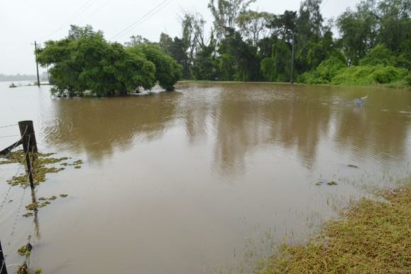
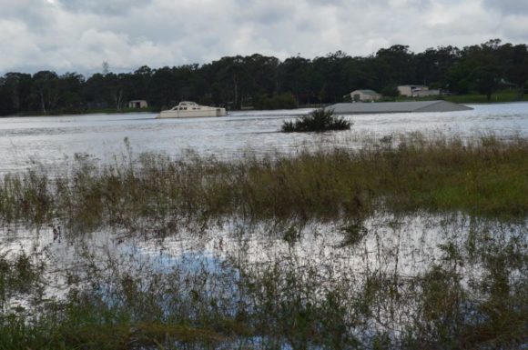
Mc Graths Hill
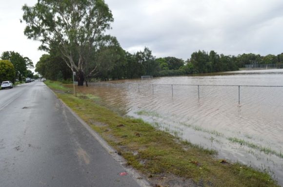
1 - Worsley Road - Killarney Chain of Ponds Creek.
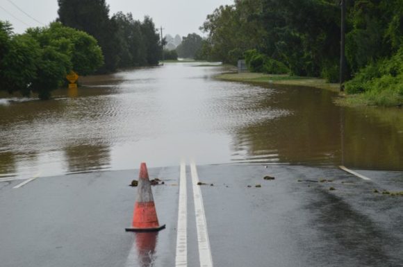
2 - Old Hawkesbury Road.
3 - Windsor Road - At that point where the road drops down onto the floodplain.
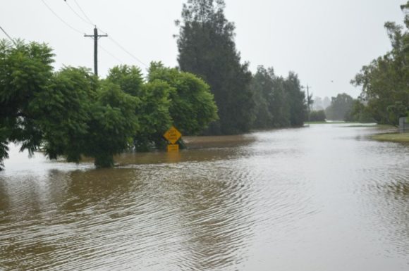
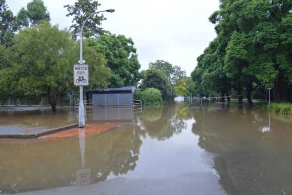
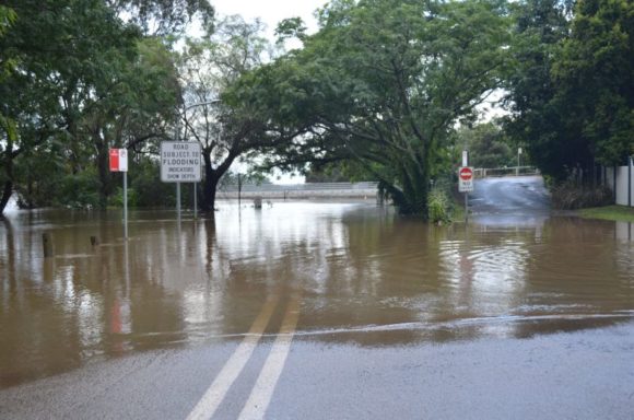
Windsor
4 - The Terrace.
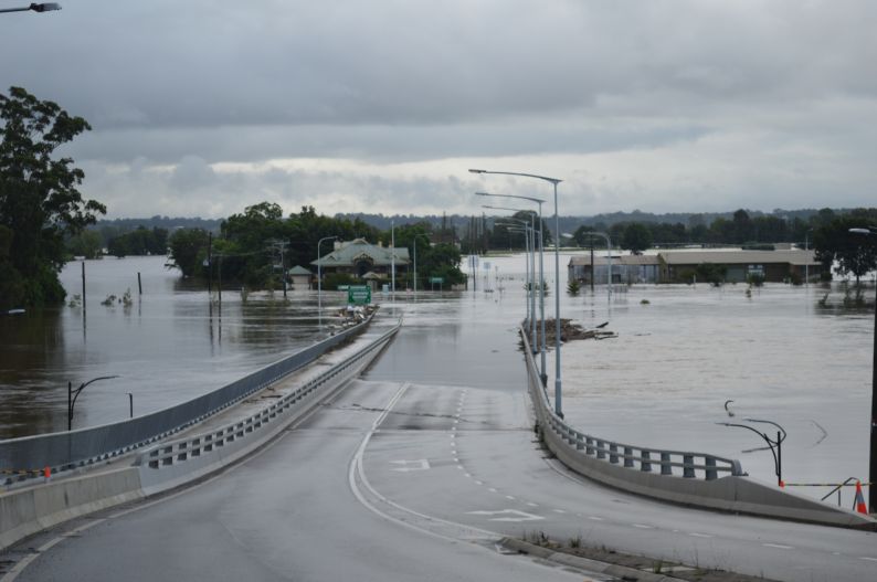
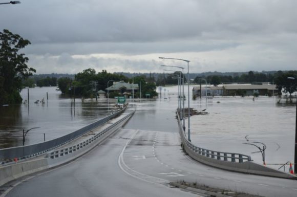
5 - The New Windsor Bridge.
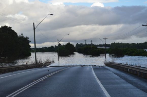
6 - Windsor Road looking east over South Creek.
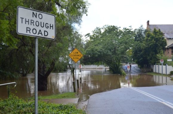
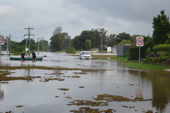
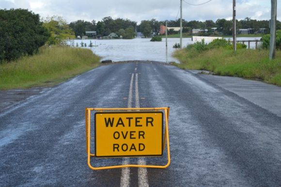
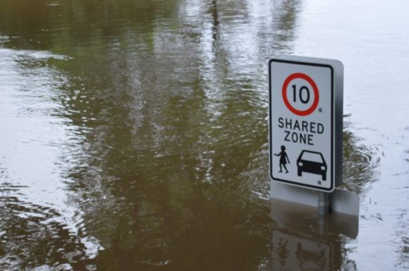
All these roads were under water where they cross the water courses and for the second time in twelve months, water was lapping over the new Windsor Bridge and the road was blocked. This time, I managed to walk out across the bridge to a point where the water was lapping over and across the road and footpath surface.
For the first time, I watched fish swim along the “The Terrace” roadway at Windsor.
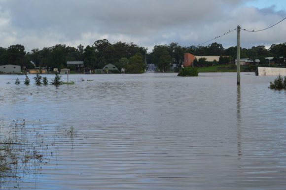
One thing I did notice was the smell of rotting timber and mud being left behind as the flood levels begin to fall. At least along Railway Terrace this time, flood levels were not lapping at the front doors of dwellings compared to last year.
While flood levels are at least 2 metres lower than that of 2021, this does not underestimate this event. The images seen here at Windsor are being repeated across South East Queensland, Lismore, Grafton, Tweed Region, Coffs Harbour Region, Mid North Coast and Hunter region of New South Wales and I am aware that insurance claims have topped $1 billion as at Saturday 5 March 2022 and rising. I am also aware of ten fatalities to date.
The rains of Wednesday were quite interesting for two reasons:-
1 - Rainfall was training (Train echo effect) over the same regions of Western Sydney for many hours.
2 - The heaviest falls occurred in a region between Blacktown and west to the mid to upper Blue Mountains. As such, Western Sydney was heavily impacted by this event.
The rains were falling over saturated river catchments from a sustained rain event. For example, there has been rain in Blacktown at some point over the past 11 days.
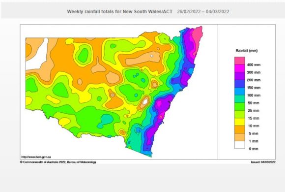
For the 24 hours to 9 am Thursday 3 March 2022, the following totals were recorded:-
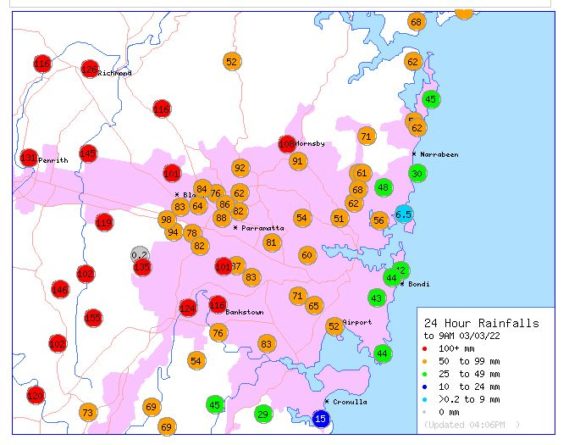
Darkes Forest - 155 mm.
Smallwoods - 151 mm.
Badgerys Creek - 146 mm.
Shanes Park - 145 mm.
Penrith - 131 mm.
Camden - 120 mm.
Outside Sydney, Robertson received 201 mm, Beaumont (The Cedars) received 193 mm, Macquarie Pass 181 mm and Porters Creek Dam 173 mm.
Cumulative rainfall totals along the coast have topped 100 mm to over 400 - 500 mm over the past week and the result are the floods that have been occurring.
This event is not over as further rainfall is being forecast and as such, the risk of prolonged flooding is high or increased. All photos attached to this post were taken using my Nikon D3200 DSLR -18 to 55 mm lens to assist with the close in photos of flooded areas.