A number of rivers across inland New South Wales are in flood following 3 days of rain, storms and heavy downpours. At the time of writing late Friday, the following rivers or areas of New South Wales are experiencing some degree of flooding:-
1 - Breeza Station - (NW Slopes and plains) - Major flooding.
2 - Kingdon Ponds at Scone - (Upper Hunter) - Major flooding.
3 - Musslebrook - (Hunter River) - Moderate flooding.
4 - Wee Waa region - (NW NSW) - Major flooding.
5 - Gunnedah - (Namoi River) - Moderate flooding.
6 - Tamworth Road Bridge - Peel River - Moderate flooding.
7 - Mendoran - Castlereagh River - Moderate flooding.
8 - Goondawindi - Near Queensland border - Moderate flooding.
9 - Molong - Molong Creek - Major flooding.
10 - Jemalong Weir - West of Forbes - Major flooding.
11 - Wellington (Bell River) - Moderate flooding.
12 - Boggabri - Namoi River - Minor flooding.
There are other rivers of concern including Darlington Point (Minor flooding) and at Jingellic (Above Lake Hume) - Minor flooding.
Three days of rain, much of it heavy falls have affected large swathes of eastern New South Wales / Victoria / Queensland and even the Australian Capital Territory.
The result has been a very wet November with rainfall being well above average. This is also being accompanied with cooler than average daytime temperatures as thick cloud cover has been persistent.
For example, it has not reached 30C once this month in Blacktown where I reside, with the highest daytime temperature being just 29.4C being recorded on the 19/11/21. So far, it has rained on 13 out of 25 days this month where I live with thunder being audible on 4 of those days.
Some of the rainfall has been significant as follows:-
1 - For the 24 hours to 9 am 23/11/2021.
Eastern Queensland - Widespread falls of 100 mm plus impacts large areas north of the Sunshine Coast including:-
Pacific Haven - 113 mm.
Leesons - 110 mm.
Childers South - 109 mm.
Miami - 105 mm.
Eastern New South Wales
Dorrigo - 140 mm.
Delward - 137 mm.
Bellingen - 100 mm.
Such rainfall has caused waterfalls on the Dorrigo Road to flood across the road linking Dorrido with Bellingen.
2 - For the 24 hours to 9 am 24/11/2021
Parts of North Eastern Victoria is drenched with falls of 26 to 43 mm occurring including the area around Bright and Myrtleford.
Upper Buckland receives the heaviest total of 48 mm.
Across the border in New South Wales, a very isolated fall of 60 mm occurs at Portable.
3 - For the 24 hours to 9 am 25/11/2021
Narrandera in the Riverina region receives 72 mm including 61 mm in 9 hours. Such a fall is rare given the location and climate.
Barellan receives
59 mm and Yanco receives 53 mm.
Jingellic receives 67 mm and Tumbarumba receives 58 mm.
Evening rain and embedded thunderstorms result in an isolated heavy total of 96 mm at Warragamba Dam in Sydney’s outer west. Sporadic lightning is also observed to the west during the evening
4 - For the 24 hours to 9 am 26/11/2021
Rainfall is widespread with some of the heaviest totals being:-
Mount Palmer - 117 mm.
Kars Springs - 115 mm.
Blackville - 111 mm.
Bundella - 106 mm.
Boomera Creek - 104 mm.
All locations are within a small area of the Upper Hunter and lower North West Slopes and Plains.
Kapooka (Just to the south west of Wagga Wagga) - 71 mm.
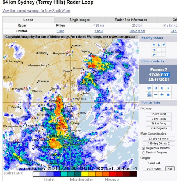
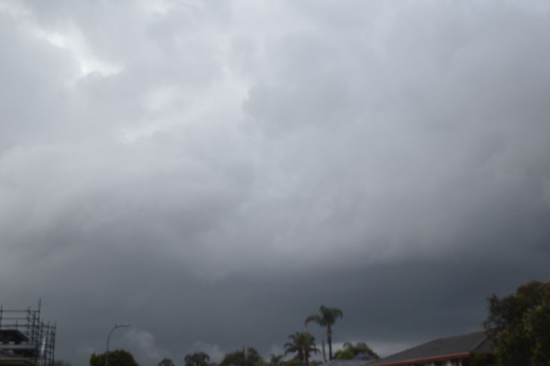
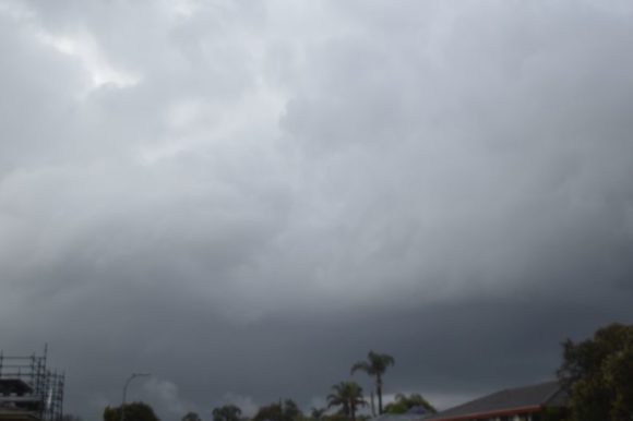
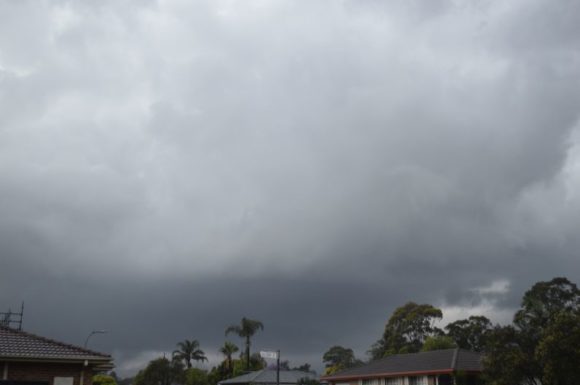
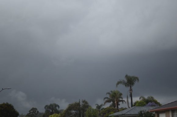
Following a humid and cloudy day Thursday, heavy rain moved into Sydney. A heavy downpour occurred at Blacktown and as it passed over, rumbles of thunder began to be heard. I managed to take photos of the cloud tower and its base only after it had cleared to the east. The thunderstorm was embedded within low cloud making it hard to identify. As the low cloud broke apart, the cloud base and parts of the updraft tower became more visible allowing me to obtain a few photos in very difficult conditions.
Much of Sydney was impacted by between 25 and 48 mm with much of this falling from that Thursday afternoon event especially around Blacktown - Seven Hills and the Parramatta region.
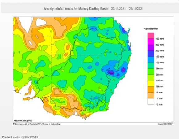
Cumulative rainfall totals have been significant with large regions of the state impacted by falls of greater than 50 mm with some areas north of the Hunter Valley being impacted by upwards of 200 mm.
While the worst of the wet weather has passed for the immediate period, further shower activity is expected over coming days.
Attached to this post are:-
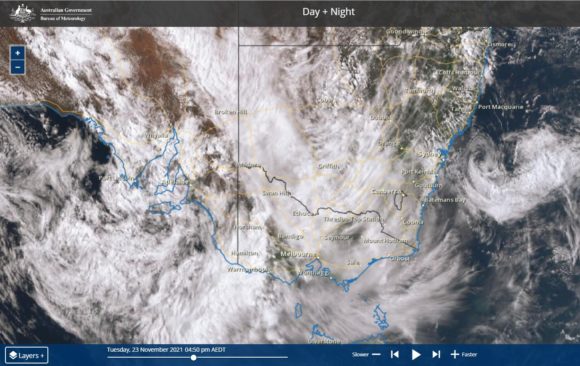
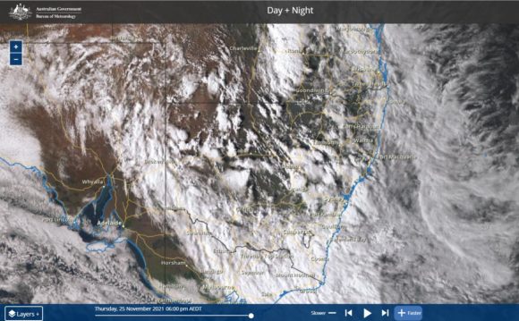
1 - Himawari satellite images showing cloud cover impacting eastern Australia.
2 - The BOM radar image of the thunderstorm cell that impacted much of Western Sydney Thursday afternoon.
3 - Cumulative rainfall for the seven day period to 9 am 26/11/2021 for New South Wales.
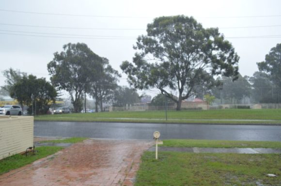
4 - An image showing typical rain falling.
5 - Three images of the storm cell taken in difficult conditions with just enough time available during a break in the low cloud cover.
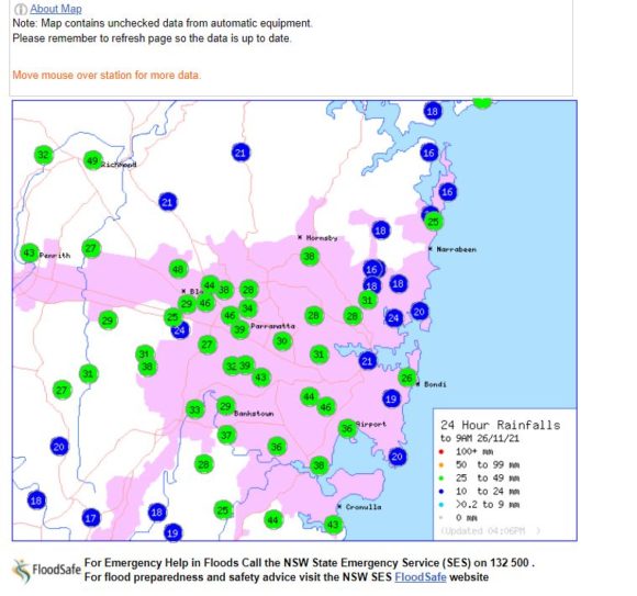
6 - Sydney rainfall for 26/11/2021 showing the spread of rain across the city.