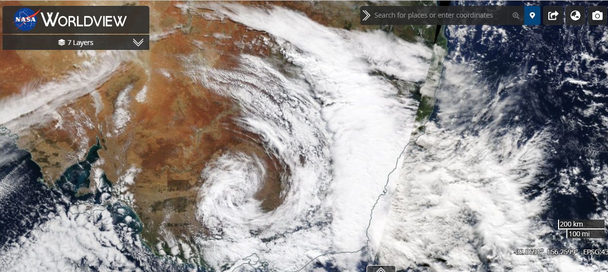
Following an exceptionally wet March and a subsequent dry April 2021, the first week of May 2021 across the east coast of Australia has again been wet.
The initial Bureau of Meteorology rain models suggested that upwards of 50 mm of rain would fall across much of the east coast especially along the coastal strip of New South Wales south of Sydney. Models suggested slightly heavier falls of between 50 mm and 100 mm could fall in isolated locations. The event would not have been considered significant for the 4 day period.

However, rainfall totals in some locations south of Sydney especially within the Shoalhaven region, an area between Ulludulla and Batemans Bay and around Bega not only exceeded expectations but have been heavy leading to isolated flooding events.
Accumulative totals have reached between 200 mm and 300 mm for the event and even across Sydney rainfall totals exceeded expectations. As a result, moderate flooding has occurred at Menangle Bridge on the Nepean River south west of Sydney and minor flooding has occurred along the Shoalhaven River at Nowra.
Some of the daily rainfall totals have been considerable during this event although falls over 100 mm have been concentrated within small localities.
For the 24 hours to 9 am 5/5/2021, the heaviest rainfall totals include:-
Black Range (Near Bega) 156 mm.
Bega River at Kanoona 123 mm.
Bega - 122 mm.
Lake Tabourie - 100 mm.
Angledale - 119 mm.
All localities except Lake Tabourie are close to Bega on the New South Wales South Coast.
For the 24 hours to 9 am 6/5/2021 some rainfall totals include:-
Brogers No 2 (Brogers Creek) - 129 mm.
Fitzroy Falls Dam - 114 mm.
Nowra ASW - 113 mm.
Brooman (Directly north of Batemans Bay) - 104 mm.
Such falls were limited to small areas. Here in Sydney rainfall totals ranged from 8.2 mm at Penrith to 40 mm at Lucas Heights for the 24 hours to 9 am 6/5/2021. There were short bursts of heavy showers throughout the day but for the most part, most rainfall totals across much of Sydney fell between 20 mm and 26 mm.
For the 24 hours to 9 am 7/5/2021, even heavier rainfall totals occurred within small areas south west of Wollongong encompassing the Kangaroo Valley, parts of the Shoalhaven region and the eastern side of the Southern Highlands around Fitzroy Falls and Robertson. The heaviest totals include:-
Brogers No 2 (Brogers Creek) - 182 mm.
Fitroy Falls Dam - 171 mm.
Beaumont (The Cedars) - 162 mm.
East Kangaloon - 156 mm.
Robertson - 147 mm.
It is clear that Brogers No 2 (Brogers Creek) has had more than 300 mm during this rain event.
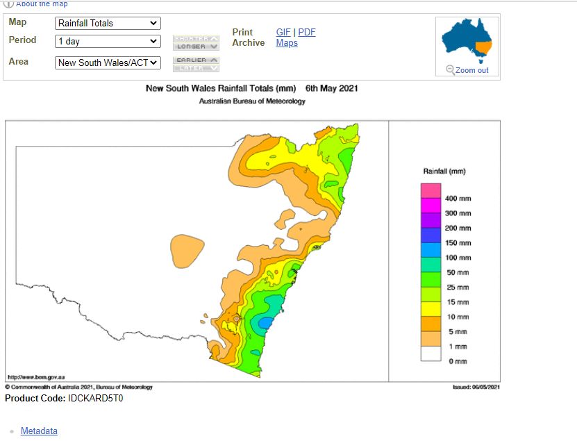
The weekly rainfall plot for New South Wales to May 7 2021 on the Water and the Land site clearly shows that large parts of the New South Wales South Coast has recorded between 200 mm and 300 mm of rain including an area south west of Wollongong, an area between Ulludulla and Batemans Bay and another small area close to Bega.

This event has impacted the Warragamba Dam catchment and it is likely that more water inflows will result in water spilling again over the dam wall.
Conditions are now clearing and further significant rainfall is not likely from this system. This will allow flood waters that have occurred to subside.