A small typhoon in the Western Pacific Ocean is gaining interest and should now be watched as it approaches Southern Japan. The storm initially formed in open ocean, developed into a typhoon, then weakened back to a tropical storm. Over recent days, the storm sustained some strength and passed into a more favourable environment, then redeveloped a second time into a Category 1 typhoon.
The storm is now being sustained by warm ocean waters in the order of 28 to 29 degrees Celsius and is now making an approach towards southern Japan.
Assuming the storm makes landfall in southern Japan, this would be the second typhoon to strike the country during July (The other being on July 16 with Typhoon Nankga).
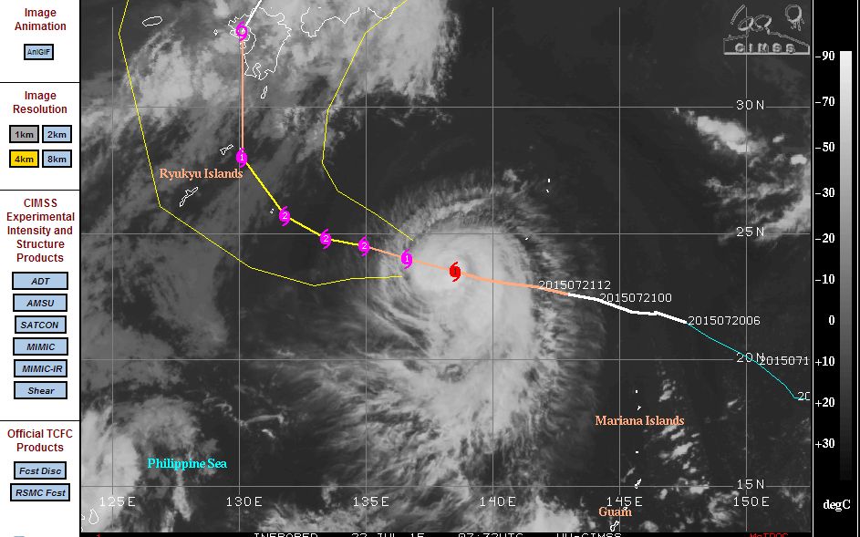
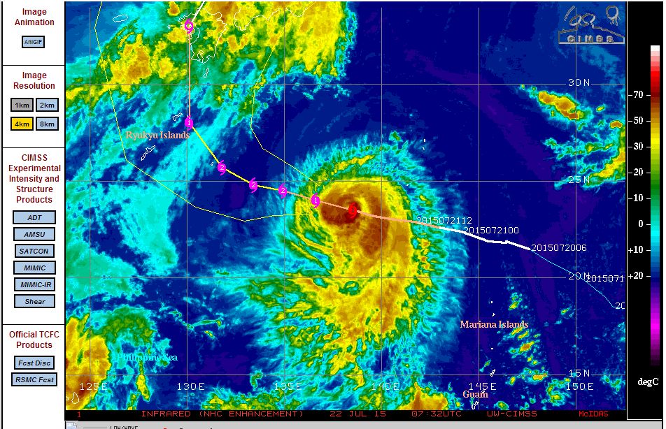
According to the CIMSS models acquired 22 July 2015, it is suggested that the storm should approach the Ryukyu Islands south of Japan then turn more northwards as a weakening storm towards Kyushu Island (Japan) and passing close to major cities such as Kagoshima, Nagasaki and Sasebo.
The CIMSS model even suggests some strengthening to a Category 2 storm before weakening. A review of surface waters show that the storm should pass over slightly warmer waters, gain strength then weaken as it passes over colder waters close to Kyushu Island.
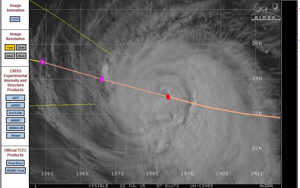
The storm is currently located at Latitude 23.5 degrees north and 138.5 degrees east and it is interesting to see some possible strengthening at a time when the storm is north of the Tropic of Cancer.
A close up view of the storm is showing some form of an eye but it is not fully visible in the attached image. The storm currently sustains winds around 75 knots at the centre.
This storm will be watched over coming days to see what occurs but it is clear that its life span will soon end as it approaches southern Japan.
Harley, is July the most common time for typhoons in Japan and in general?
A little research identifies that the north west Pacific Ocean basin including Japan, Philippines, Taiwan and southern China would see at least 32 such storms in an average year (Being 32 storms for the entire region).
The maximum number has reached 44.
In a typical year, the peak for such storms is anytime from July through to September. Tropical storms are most frequent and most violent over the tropical Western Pacific Ocean and one reason for that is the vast area of warm water available to sustain such storms. In addition to certain atmospheric setups to start their process, the storms do need oceanic waters of at least 27C to sustain them. The Western Pacific Ocean has a vast area of water that reaches or exceeds the minimum temperature.
Perhaps north east Luzon Island is amongst the most prone area in the world where a typhoon may make landfall. Up to 10 could make landfall in any given year. As such, parts of eastern Luzon Island has a lower population than other areas of the Philippines probably due to the number of typhoons that affect the area.
This whole region is at risk from July to September and thus warning systems are required for populations.
(Source Christopher C Burt Extreme Weather 2007 PP222-224)
Not diverging too much from the topic, the latest satellite photo and model from CIMSS (Acquired 24 July 2015) still shows Typhoon Halola (Upper north east of the picture) which is travelling Closer to Japan but weakening.
However the image also shows a tropical storm (Currently named Tropical Storm 12) over Northern Luzon which has just formed in the past 24 hours. It is not clear what that storm will do at the present time. If it moves off the coast as suggested, it would also start to track north east towards Japan.
The two storms shown in the image highlights the threat the tropical storms and typhoons pose at this time of the year (July through to September) for that whole region.