
This has been a dull day in NSW history with numerous fires including several fire emergencies. Catastrophic conditions lead to fast moving dangerous fires to spread quickly through suburbs particularly in the Springwood fires.
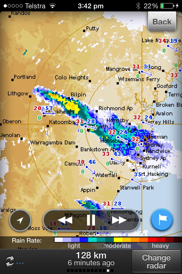
Thanks Nick for posting this radar - wow when you see echose like this from a bushfire plume!
It is feared that amongst all fires, hundreds of homes may have been lost – dozens lost in the Springwood and Winamalee region.
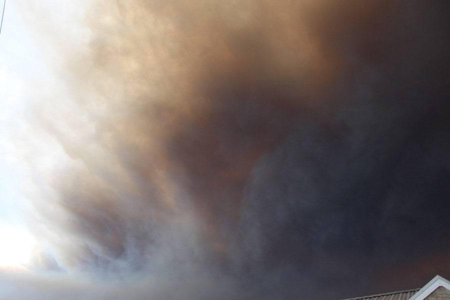
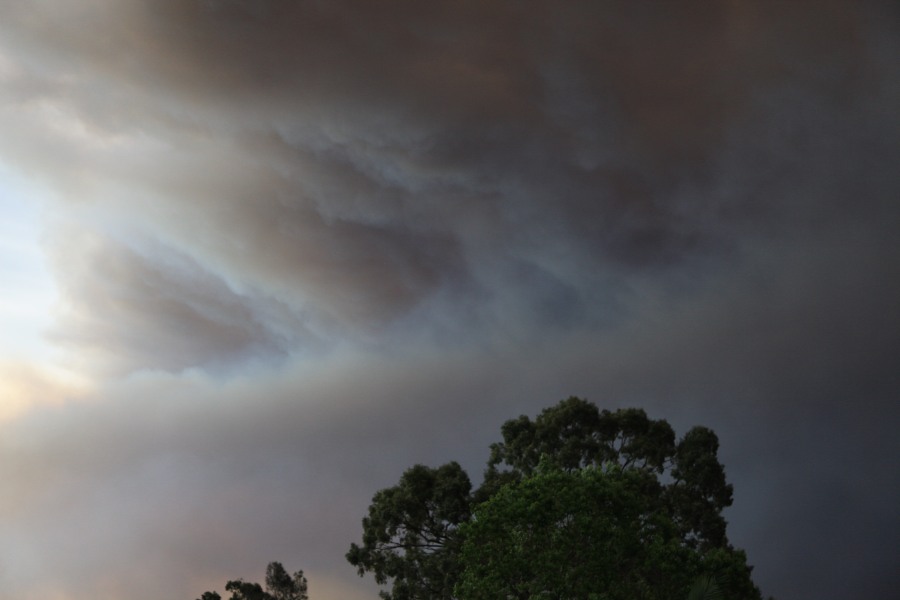
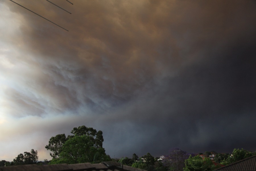
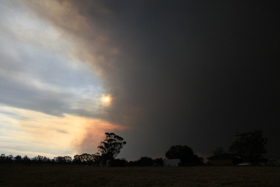
Thursday afternoon I took a great photo of the smoke plume pouring over Sydney from Auburn City Council roof top car park. The skies had turned dark from the smoke and fires lapping at the edge of Sydney.
Initially the smoke plume was over Sydney but as the drier SW wind change passed over, the plume was pushed northwards.
Temperatures peaks at 33C to 34C across Sydney prior to the wind changes setting in.
Harley, that smoke plume is what greeted me in peak hour traffic on Sunnyholt Road. The occasional black leaves “precipitated” out of the sky. Although most of the media focus was on the event near Springwood, the major backshear anvil of the fire was from the fire in Lithgow.
This was an event I was expecting sooner than later. The conditions were ripe for dangerous fires. The question that has not seemed to be hinted from the media is that was the fire deliberately lit? Well no lightning in the area, the rapid spread of the fire in one afternoon and the seemingly maximised damage of the homes in the path makes this fire particularly suspicious.
Latest investigations have pointed to power lines rather than fire bugs as the cause of the devastating bush fires in the Springwood area.
Sunday afternoon (23/10/13), I took a risk and drove up to the western flank of the bushfires burning around Lithgow and Mt Victoria. Initially, I drove to Richmond to see how bad things were further west, then went south towards Penrith.
I could clearly see the devastation wrought by the bushfires around Winmalee on the hills to the west and in the distance, I could see the serious damage done. I did not venture into davastated area.
Instead I drove up to Katoomba and found the highway fully open and serious smoke haze around Springwood. Further up the mountains, I broke out of the smoke into clear skies and large pumes of smoke were visible to the north. I initially proceeded to Medlow Bath, then Blackheath. I took in the views of the fire to the north from Govetts Leap and found many bushtracks closed.
I soon discovered the road to Mt Victoria was open and went there. I was able to take photos of smoke plumes close by. I stopped at the Darling Causeway road block and watched some of the fire fighting effort. I advise the Darling Causeway is / was blocked only 100 metres from the traffic lights.
At Mt Victoria, I soon discovered the shrill and noise of cicadas which was deafening but I saw few birds.
I proceeded down Victoria Pass where I passed a spot fire on the side of the road. The highway was open but a large spot fire had taken hold. For a few brief seconds, I felt the heat of it but it soon passed. I proceeded to Hartley Vale where I watched the fire and fire fighting effort for a number of hours.
The photo above shows the spot fire I passed just below Victoria Pass. I positioned myself some 500 metres west of the flames. If one look closely, flames can be seen. I watched a single helicopter fight this blaze using water from an adjoining dam. The aerial bombardment was successful after some 1 to 2 hours of constant bombardment using water from the air.
A nearby dam was being used for the fire fighting effort by helicopters.
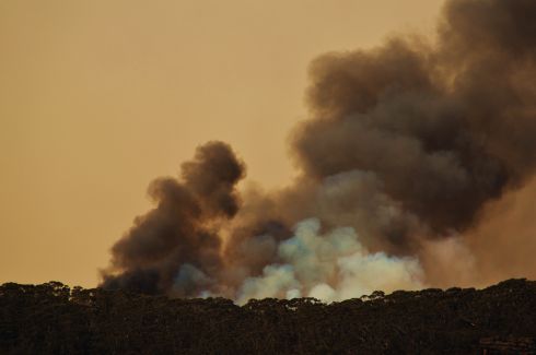
I took numerous photos of hillsides on fire 1 to 2 km to the north and east of me and it seemed that half of my vision to the east was obscured by smoke and flame. It was perfectly clear to the west. I have never seen such a sight, only in books. I was careful and took my photos in safety. Flames were visible on hillsides and again, I did not see many animals or birds.
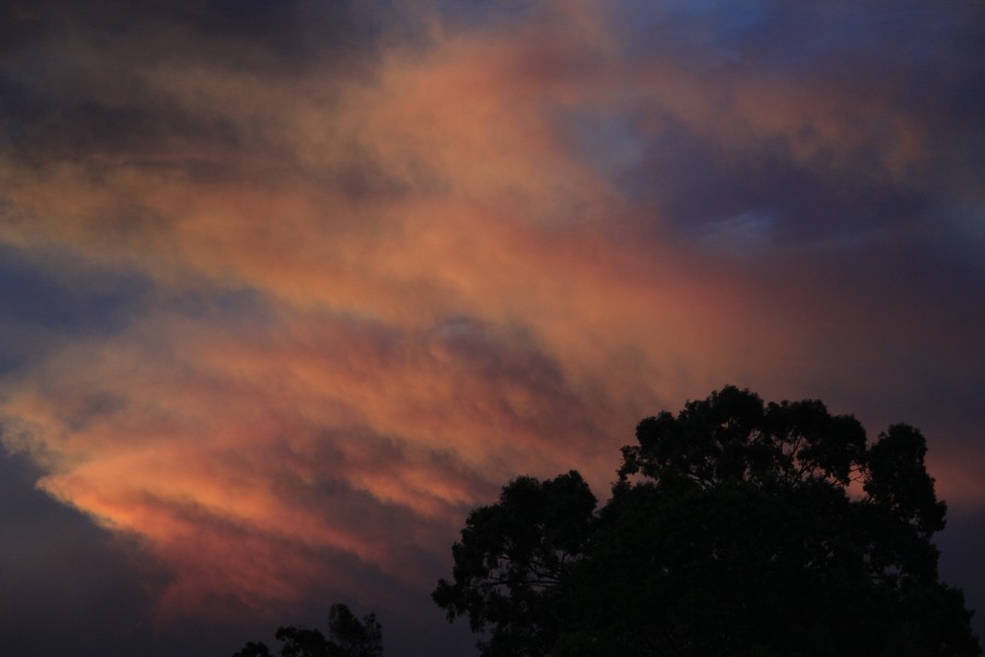
Towards the latter part of the afternoon, the north westerly winds picked up strength and the result were new plumes of smoke visible on the ridglines near Mt Victoria. Watching this, I sensed the Mt Victoria fire was out of control. I watched several helicopters skirt the smoke plume and even saw an Erickson Helicrane in the distance fighting the fire. This plume seen in the photo lasted a considerable time.
At approximately 4.45 pm, I left the disaster area and returned home back to Sydney after having seen the Lithgow fire and Mt Victoria bushfires close up.
I advise at the time, the Great Western Hwy was open but fire units were being stationed along the road around Victoria Pass. Most bushwalks and scenic lookouts in the vicinity were closed, cordoned off or policed. Further, Total Fire Ban Notices had been placed in many areas and roads impassible such as the Darling Causeway.
Anyone driving in this area must be careful of what is going on as this is a very big fire.