These images are taken between December 30 2019 and January 1 2020 during our visit to the South Coast - Batemans Bay. We were certainly aware of the Currowan Bushfire west of Batemans Bay which had been burning for a number of weeks leading up to this catastrophic event.
My wife and I were only here due to new years eve and a planned BBQ with parents. However things quickly turned dangerous upon our arrival 30/12/2019. During the afternoon, thick choking smoke enveloped the entire south coast but towards evening this smoke lifted and at sunset, my wife and I were shocked to discover that the northern part of Batemans Bay was underneath a Pyro - cumulonimbus cloud that was capable of generating lightning strikes. This did not occur although a similar cloud formation to the south which could be seen in the distance did generate lightning strikes.
More alarming though was the fact that warm embers were dropping from this pyro cumulonimbus cloud and we knew this was dangerous. I picked up one ember which was warm.
Throughout the night the glow of the fire to the west was visible and early morning the wind increased from the north west. By daybreak we learnt that the bushfire had raced out of the state forests and that Mogo was heavily impacted by flames. Fanned by the hot dry north west winds, the fire front tore through Mogo obliterating most of the town although the Mogo Zoo was saved. Mogo is just 12 km south of Batemans Bay.
More alarming was the fire front that raced towards Catalina and after 9 am the street where my parents live was evacuated. A number of fire brigade units and Police swarmed the area ordering us and residents to drop everything and evacuate immediately to Catalina Beach - The Safe Zone.
Another fire front tore through Malua Bay, another suburb of Batemans Bay to the south.
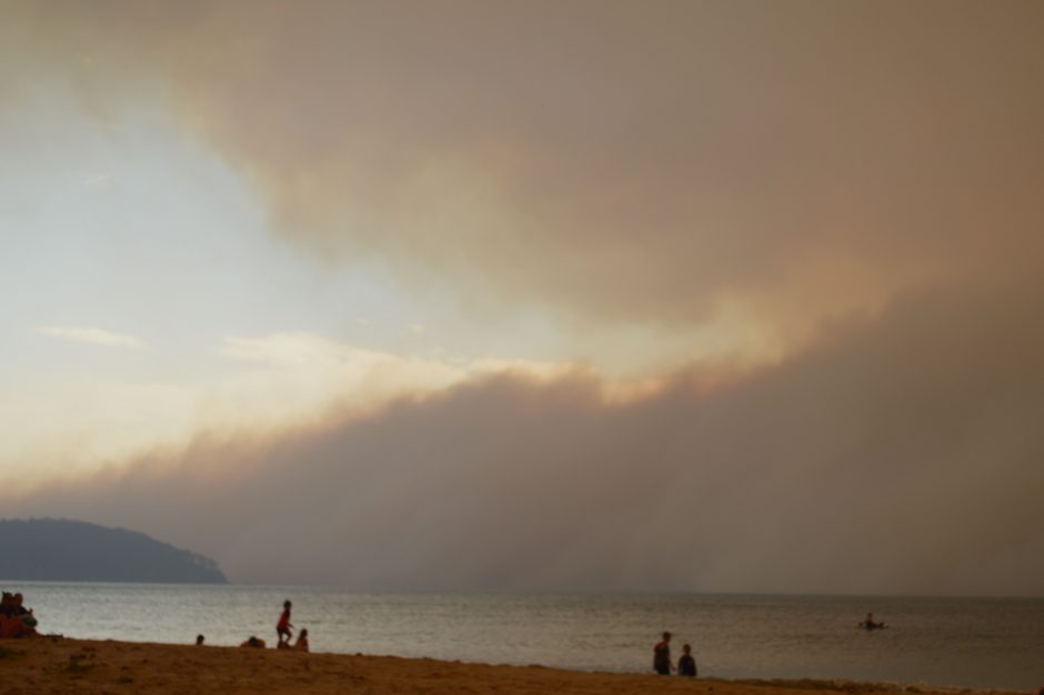
In a few minutes with flames imminent, we fled to Catalina Beached and watched a bushfire catastrophe unfold. I have never seen anything like this other than on TV news.
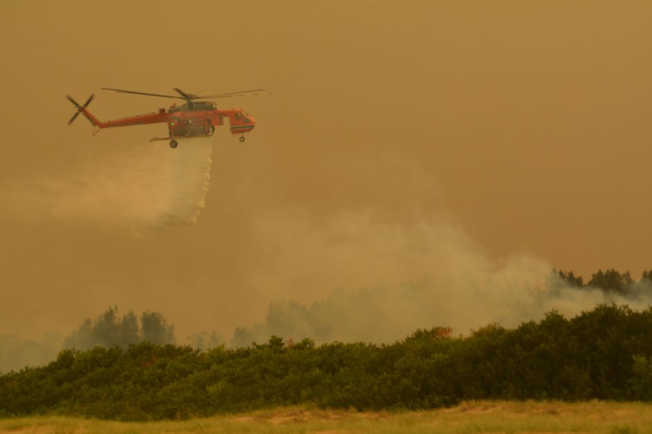
During this time a large spot fire broke out adjacent to the beach which required the use of a Heli crane to tackle. It was later tackled using no less than 3 helicopters.
More alarming were the fact that houses were on fire within the street where my parents live. With thousands of residents and holiday makers taking refuge on the beach we were watching a full scale aerial bombardment with the use of a DC10, a Boeing 737 jet and a third possibly a BAE146 Jet, flying low to the ground one after another.
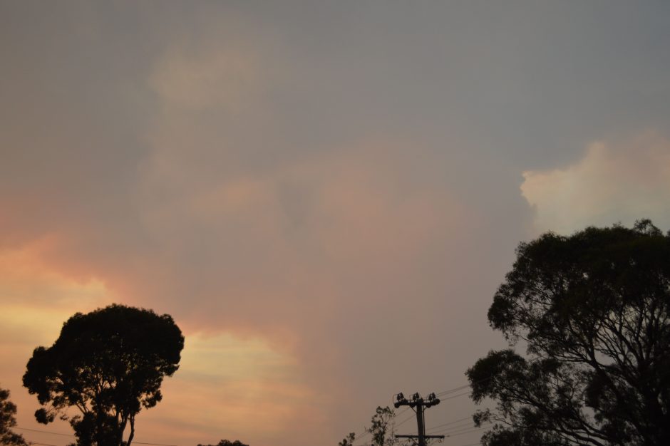
The southerly change blasted through turned the air into choking ash, smoke and dust and day turned to night. This lasted approximately 20 minutes and the sky later turned orange.
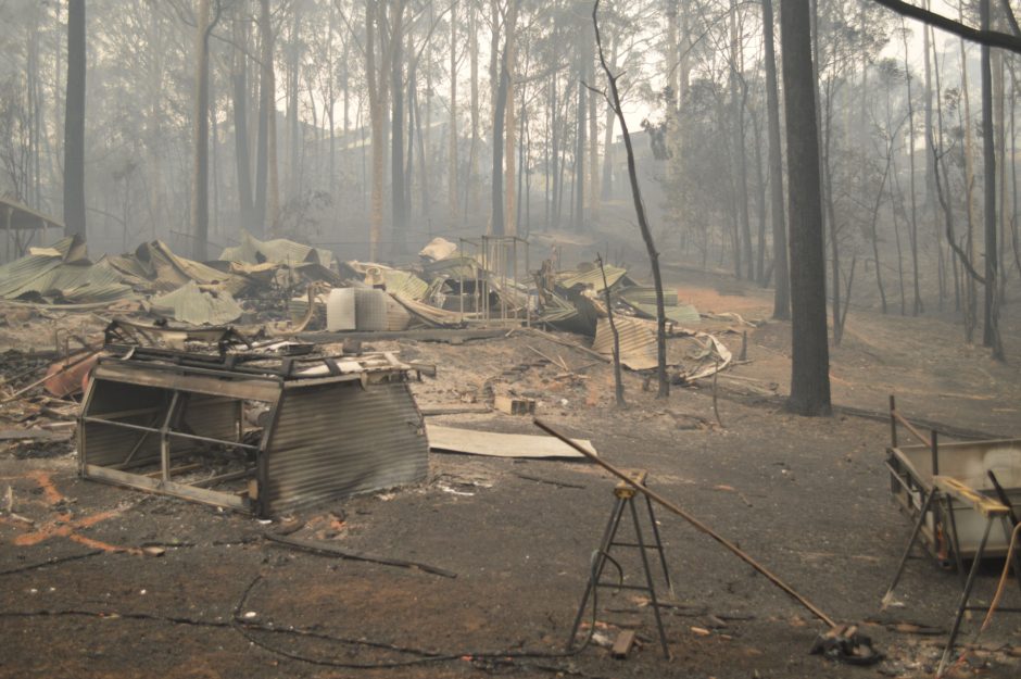
At around 1 pm, my wife and I returned to Country Club Drive where my parents live and were shocked that the fire came to within 30 metres of my parents home, a resident on the opposite side of the road had flames burning at his fenceline, a house was on fire close by and a number of homes were burnt to the ground. We later counted some 22 houses destroyed within 200 metres of my parents home.
My wife and I were required to put out smoke coming from a spot fire in a tree in my parents rear yard which shows how close the fire came.
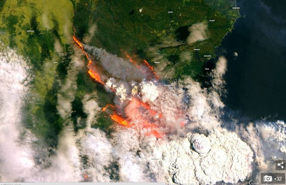
Infrastructure was destroyed, power knocked out, we had no idea what was going on. A drive by of the area the next day identified significant losses over town with the fire still burning. The images of Batemans Bay on fire on this day being new years eve / new years day is one of many fire disasters that hit eastern Australia during this time with the South Coast heavily impacted.
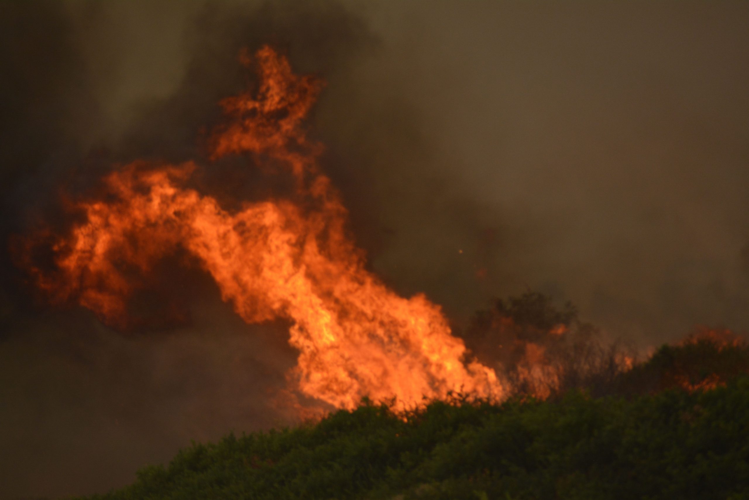
Some of the most enduring images is this fire that broke out at the evacuation centre. This also became an emergency within an emergency due to the proximity of flames near Birdland and bushland. This was tackled as the southerly change rolled through.
These are images is what it was like as the southerly change passed through which saw the fire front change direction. Day turns to night as choking clouds of smoke rolls over. It was almost impossible to breath. This night time scene lasted approximately 20 minutes before the sky turned a deep orange colour.
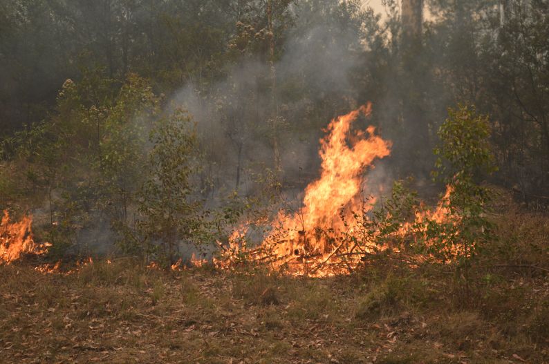
These show the fire advancing and what it was like as the fire hit Batemans Bay. The worst affected areas were Catalina, Malua Bay, Surfe Beach (Inland) Mogo. The industrial estate was heavily impacted and Bunnings damaged. I did read reports at the time some 382 houses or buildings destroyed but unsure of the final number.
For all the losses that occur, watching homes burn down is not easy. The houses on fire are located barely 200 metres from my parents house in Country Club Drive. Heron Drive, Heron Court and Kingfisher Court were hit hard by the disaster.
Watching peoples homes burn is difficult however this was the outcome. The total housing stock lost in the vicinity of Country Club Drive (Catalina) was 22. Most loses occurred in Heron Drive, Heron Court, Kingfisher Court. Other others were damaged although by September 2020, a number had been repaired. Notwithstanding this many residents have not rebuilt as at October 2020 due to the events that had occurred.
The fire was not put out on January 1. It continued to burn unchecked for days, weeks until put out by rains in February. Damage losses for this entire event is still not fully known although losses are well over $4 Billion have been published although when accounting for the human element, the loss of employment, damage to infrastructure, cost of fighting the blazes, total costs in excess of $104 Billion have been discussed.